
Looking Up Springville Neighbors
A Springville neighbors search begins with one known address and a defined radius. The county Parcel Map can identify the parcel, display boundaries, and link to owner or property information. The Assessor card can show the owner, situs, mailing address, serial, lot description, and values. These are parcel facts. They do not list every person who shares a home.
For block context, use the county voter request rules, city cadastral layers, historic street-order directories, and community sources. Each adds a different kind of lead. Compare dates and keep the source label attached to every name.
| Source | What It Shows About a Block | Access |
|---|---|---|
| Utah County Parcel Map | Adjacent lots, serials, geometry, layers | Free public viewer |
| Utah County Assessor | Owner and mailing address per parcel | Free property search |
| County voter request | Authorized voters, precincts, districts | Paid request, use limits |
| Springville cadastral service | City limits, parcels, annexation layers | Public REST map |
| Community and directory sources | Voluntary or past block context | Coverage varies |
An owner record proves a recorded property relationship. A mailing address shows where tax mail is sent. Neither alone proves who your neighbors are today. Registration can be stale, and a community association is not a public roster.
Map a Springville Block
The Utah County Parcel Map supports an adjacent-parcel workflow. Search the known address or serial, zoom to the lot, turn on parcel boundaries, and identify each adjoining parcel. The viewer also accepts owner names, PLSS section, township, range, and city, with aerial basemaps, layers, historic parcel mode, measurement, and export tools.
- Locate the known address in the Utah County Parcel Map.
- Enable boundaries and identify each lot that touches or sits beside the starting parcel.
- Save each serial, owner, situs, mailing address, and lot or subdivision description.
- Compare the result with Springville cadastral city-limit and annexation layers.
- Use the full street chain only when the question expands beyond the immediate block.
The Springville street directory route is the better handoff when the search expands to every address along a named street.
Springville Cadastral Boundaries
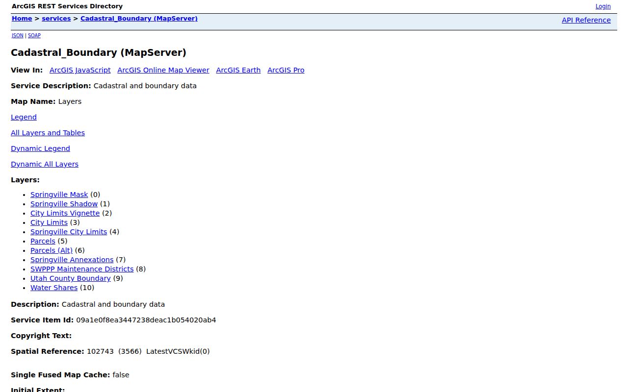
The Springville cadastral service adds city limits, parcels, annexation layers, alternate parcels, the Utah County boundary, and related map data. Its REST service supports identify, query, and export, with a maximum of 1,000 records. It helps distinguish county parcel coverage from the municipal question.
Exact ordinance years for every boundary adjustment were not exposed in the research. Use the City Recorder’s official boundary map and a GRAMA request when the date of an annexation matters. A county parcel close to Springville may need both custodians.
Springville’s cadastral map service provides the local boundary and parcel layer used to place nearby neighbors.
Note: The county map’s historic parcel date is an online-system entry date, not the date a deed was recorded.
Voter Data Around a Block
Utah County’s voter-list request form can select residence cities, voting precincts, political districts, party, and optional vote history from 2016 forward. Springville is available as a residence city. The file is emailed as an Excel document after a $5 setup fee plus $1 per 500 names, with up to two business days noted. A purpose, certification, secure-handling, and political-use rule applies.
This route does not provide a simple public street browser or ZIP filter. Public standard fields can include name, voter ID, age range, address, precinct, districts, party, status, update date, and vote history. Full birth date, phone, email, driver-license data, Social Security number, and at-risk identities are private or withheld.
Springvale and Community Context
Springvale Homeowners Association supplies a local community-network lead. Its public page does not verify a comprehensive Springville association directory, geographic coverage, membership, or public member names. Treat it as a contact layer, not as an official list of Springville neighbors.
Springville community-plan pages name areas such as Westfields, Lakeside, Historic Center, Dry Creek, and North Community Development Project Area. These names can help orient a project or block, but a plan is geography and civic context, not a roster. Ask the city about the proper public contact for a neighborhood question.
The located Springvale association page illustrates the community layer available beside official parcel and boundary records.
Buildings Before Households
Springville Sanborn sheets from 1890 and 1898, plus later historical map holdings, can show the structure, street label, lot shape, and use around a block. They are useful when an old neighbor record names a building that no longer looks like the current parcel. A map can also help align a directory’s street order with the modern GIS view.
Sanborn sheets do not identify every resident. Pair them with a directory, census, newspaper, deed, or cemetery record. The local library’s historical tours and fixed addresses can add place context, but they do not replace a parcel or occupant source.
Past Neighbors in Print
The Springville Herald search from 1924 through 2008 can reveal a dated neighborhood event, obituary, legal notice, or address phrase. Springville-inclusive city-directory reels from 1901/02 through 1959 may show a street-order household snapshot, with known missing issues. Use the issue year and page, then test a name against the cemetery or Recorder record.
A missing directory issue is not an empty block. A name may also be absent because a household was unlisted, a person moved, or the publication used another city label. Historical neighbors are best treated as a time-stamped lead.
Privacy Limits for Springville Neighbors
A neighbor lookup cannot reveal every person in a home. Renters and household members may not appear in property records. Utility and delivery data are not public resident lists. Voter data has private fields and at-risk protections. Safe at Home provides eligible survivors a substitute legal address and protects the actual location, mail, city, county, precinct, phone, and identifying details.
Lawful use. Springville neighbor records are for lawful block, family, property, or civic research. Do not use them to watch, stalk, harass, threaten, or expose anyone.